Appearance
Costmap Navigation
Problem Statement
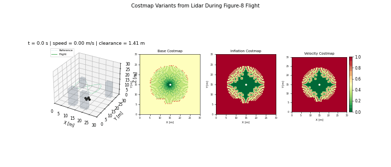
Costmap navigation fuses occupancy information into a traversability surface used for local replanning and obstacle avoidance. It bridges mapping uncertainty with actionable path costs.
Model and Formulation
A costmap cell combines occupancy, inflation, and dynamic penalties:
$$ C(x,y)=w_o C_{occ}(x,y)+w_i C_{infl}(x,y)+w_d C_{dyn}(x,y) $$
Local planning repeatedly solves shortest-path queries on the evolving cost field.
Algorithm Procedure
- Update occupancy with sensor observations.
- Apply footprint inflation and dynamic obstacle penalties.
- Replan local route at fixed frequency.
- Feed feasible path segments to tracking controller.
Tuning and Failure Modes
- Over-inflation can block narrow but valid corridors.
- Under-inflation reduces safety margins near moving obstacles.
- Replan frequencies that are too low produce stale avoidance behavior.
Implementation and Execution
bash
python -m uav_sim.simulations.environment.costmap_navigationEvidence
References
- Fox, Burgard, Thrun, Dynamic Window Approach (1997)
- Lu et al., Layered Costmaps for Context-Sensitive Navigation (IROS 2014)